


Dozens of schools are shut and people are facing travel disruption as high winds sweep Scotland, with warnings of 70mph gusts.
A Met Office yellow warning covering the whole of Scotland and the far north-east of Northern Ireland was issued on Tuesday.
It was originally in force across the whole area until 9pm but was lifted in much of it during the early afternoon and is now in place until 6pm in northern Scotland.
All schools in the Western Isles are closed on Tuesday due to the high winds forecast while in the Highlands 30 primary schools and six secondary schools are shut due to weather-related issues, as are eight in Aberdeenshire.
The Met Office warns that gusts of 50-60 mph are possible quite widely while some exposed or coastal areas in the north-west and far north of Scotland could see gusts of 70 mph or more.
In North Ayrshire, the search for a person thought to have been swept into the sea at Largs by large waves was suspended after nobody was found.
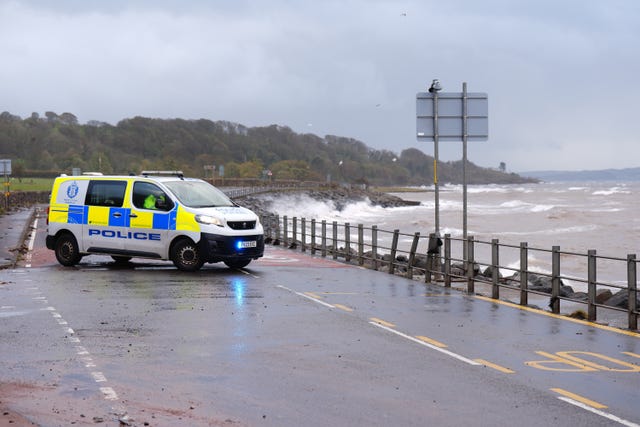
HM Coastguard said a coastguard helicopter and aeroplane went to the scene, along with RNLI lifeboats from Largs and Troon and coastguard rescue teams, when the alarm was raised at about 12.20am on Tuesday, as did police and the fire service.
The coastguard said that following an “extensive search”, nobody was found and searches were suspended at about 9am, pending any new information.
Police Scotland said: “A search-and-rescue operation was launched but the person remains missing.”
The Met Office said that a gust of 76mph was recorded at Stornoway Airport on Tuesday and one of 71mph on Tiree.
The latest weather warning comes as the clean-up continues following Storm Boelo which hit the UK over the weekend and left two men dead.
On the railways, speed restrictions are in place on some routes in the north and west of Scotland on Tuesday.
Network Rail Scotland said restrictions are in place on the west Highland line (including to Oban and Mallaig), far north line, Highland main line (Blair Atholl – Dalwhinnie), Inverness – Kyle of Lochalsh, and Aberdeen – Inverness routes.
In the west, they are in force on the Girvan – Stranraer, Kilwinning – Largs and Dalreoch – Helensburgh Central routes.
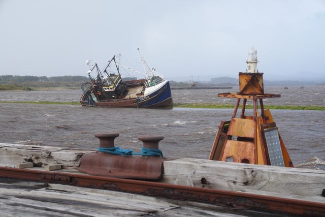
On Tuesday morning, ScotRail said train services between Edinburgh and Dundee would be delayed or revised due to high winds on the Tay Bridge.
In Ayrshire, services between Kilwinning and Largs/Ardrossan were suspended late morning due to high waves near the railway line between Stevenston and Saltcoats but later resumed once the situation improved.
Some ferry services are also disrupted due to the weather while, on the roads, the northbound onslip onto the A9 at Stockbridge, Dunblane, was shut due to a fallen tree but later reopened.
Two men were killed by falling trees on Sunday: a man in his 20s in Finchley, north London; and Richard Baines, 60, in Dumfries and Galloway.
Scotland’s First Minister John Swinney on Monday expressed his condolences for the two men.
Mr Baines, a curator at Logan Botanic Garden, a regional garden of the Royal Botanic Garden Edinburgh, died while walking near his home during the storm.
David Knott, director of horticulture at the Royal Botanic Garden Edinburgh, said Mr Baines was an “enthusiastic plantsman” and would be “deeply missed by many”.
Two women were also taken to hospital after they were hit by a falling tree in Aberfeldy, Perth and Kinross.
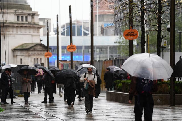
On Tuesday, a separate yellow wind warning for western areas of England and parts of Scotland, Wales and Northern Ireland expired at 3am.
As of 9.30am on Tuesday, the Scottish Environment Protection Agency (Sepa) had 13 flood alerts and 39 flood warnings in place while the Environment Agency in England had issued five flood warnings that flooding is expected and 41 alerts that flooding is possible.
Natural Resources Wales had two flood warnings and eight flood alerts in place.
The Energy Networks Association said that, as of 8am on Tuesday, 829,400 customers around the UK have been reconnected following storms Austen and Boelo while 7,800 customers are without power.
The Scottish Government Resilience Room met on Monday to discuss the situation.
Scotland’s Social Justice and Housing Secretary Shirley-Anne Somerville, who chaired the meeting, said: “I would urge the public to continue to check their local weather forecast and follow the advice of the Met Office, Sepa and the police to ensure they stay safe.”
On Tuesday, early rain is to clear across eastern and south-eastern England while heavier rain in the north-west of Scotland will gradually turn to showers, the Met Office said.
🌧️⚠️ Due to heavy rainfall, speed restrictions are in place on parts of our network. Journey times will be extended, and disruption is likely.
ℹ️ Please check your full journey before travelling via our app, website, or https://t.co/1VsL9fhInG, and allow extra time for travel. pic.twitter.com/MuxfO1Kn6A
— ScotRail (@ScotRail) October 27, 2026
The strongest winds will continue to affect Scotland, particularly in the far north and north-west where gusts in excess of 70mph are possible.
Elsewhere, there will be sunny spells and showers will continue, with some heavy rain in western areas.
Conditions will begin to settle down from Wednesday as high pressure increasingly begins to influence the UK, the Met Office said.
This will bring lighter winds and drier weather across much of the UK on Wednesday evening and Thursday, though western areas may remain breezy and experience a few light showers.
Greg Dewhurst, senior operational meteorologist at the Met Office, told the Press Association: “Most will have a day of sunny spells and blustery showers on Tuesday, showers heaviest and most frequent in the north.
“Thereafter for the week ahead we see a change in the weather. High pressure will build from the south over the coming days, so generally settling down but potentially bringing some overnight fog at times.
“This high pressure looks set to remain over the UK for the weekend too. So, most places dry, though perhaps some patchy rain in the north at times.”


Share